Tuesday, May 13, 2008

Lost Residences of Downtown Denver

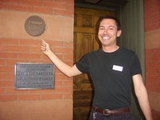
Recently I've been researching aspects of Denver's lost residential neighborhoods of yesteryear. It may surprise most of you to know that downtown Denver and its adjacent neighborhoods were once filled with lovely residences and some not so lovely residences--housing of all types. Many of the parking lots we see in and around downtown today were once occupied by homes. Some of these houses were later supplanted by businesses. The last home standing in central downtown is the Curry-Chucovich-Gerash House at 1439 Court Place on Block 207.

To get a sense of what this neighborhood near the Arapahoe County Courthouse once looked like, here is a picture circa 1890 to get us in the right frame of mind:


This area, between Tremont and Glenarm Places, features a now rare Second Empire designed home. That is the house with the mansard style roof. Hidden in the trees to the right is the Curry-Chucovich-Gerash House, circa 1888 with the Arapahoe County Courthouse dominating the skyline.


Just down the street at 1308 Glenarm stood the Amos Steck House:


Mr. Steck was on the first Denver School Board. He gave land to the East Denver School District that was eventually used to build the first permanent school building in Denver, the Arapahoe School.


Aside from Curtis Park, which remains remarkably intact north of 23rd Street, there isn't much residential remaining south of that line, except for the random house here and there in the Arapahoe Square area. One nearly intact block remains however. Staving off demolition during the mid-1970s when its neighborhing blocks were bull-d0zed to make way for the 1976 Winter Olympics Housing, this block formed the Clement's Historic District. Compare this link of the current street with what we can see of some of the 2100 block over a century ago:


The houses in the far right side of this picture (circa 1900) remain intact today as part of the Clement's Historic District.

The neighborhoods to the south of downtown didn't fair much better. The residences of today's Golden Triangle or Civic Center neighborhood was even more obliterated during the 20th century, first to make way for Civic Center Park, and secondly to make way for libraries, art museums, parking lots and associated businesses. The neighborhood lost so much population that by 1973, the Denver Public Schools closed down the area school: Evans Elementary. That building still stands today but is not in use. Recently, an old picture made its way to the Byers-Evans House Museum (circa 1883). This picture was interesting because it showed people smiling in front of homes that were long ago demolished to make way for the Denver Art Museum's North Building (circa 1971 by Gio Ponti). The only hold-outs from that construction project were the Evans sisters, granddaughters of Colorado's second territorial governor, John Evans. They stayed put and today, their house is a museum (and my workplace). The picture of their neighbor's house to the north at 1316 Bannock is quite a treasure to see today:

Family and friends at 1316 Bannock in 1910. The use of the rusticated sandstone and granite on the home is a hallmark of architect William Lang, notable for his many beautiful houses in Denver, including the Molly Brown House and the Castle Marne. These large homes, including the large Queen Anne on the left, complimented the Italianate style Byers-Evans House at 1310 Bannock.


All black and white historic photos are from the Denver Public Library's Western History Collection except for the picture of 1316 Bannock.


Friday, April 11, 2008

The Masonic Building and Welton Street


Ah, the Masonic Building (1889). This downtown institution almost was lost to us back in 1985 due to fire. Without the intervention of preservationists and other interested parties, the Kittredge Building would be alone. The fire damage was significant which resulted in only the facade being salvaged, but we'll take it! This building, designed by Frank Edbrooke, is one of a few of his many notable projects still left standing downtown after so long. Others include the Brown Palace and the Oxford Hotel.


In the distance in this picture, one can also see the Kenmark Hotel at the corner of 17th and Welton, and beyond that, the current Grand Hyatt at 18th and Welton. The Kenmark, known as Hotel Kaiserhof until WWI, was recently demolished in 1995. "They" said it couldn't be saved, that it had to go. And today, we have a "nice" vacant lot/parking lot on that site.


But what about the other lesser known buildings along Welton Street "behind" the Masonic Building. I spend my days and nights doing a lot of research for many different projects--that's why I can't post here everyday--but it does point to the problems inherent with historic building research. One wants to ensure accuracy and sometimes that means digging more deeply than just the online photo archive at the Denver Public Library. And sometimes, the evidence is not readily available, especially for less flashy buildings that sometimes faced the city's interior blocks. Such is the case with the even addresses found along the 1600 block of Welton.


While doing other research, I stumbled upon the picture below:


The dotted line in this picture is hovering over the Mack Building which stands along Welton next to the Masonic Building. This photo is circa 1953. The information on the back of this photo indicates that the Mack Building had been on the site since 1883. It was to be torn down and to make way for a seven story office building. This is where more research would be needed! The Denver Public Library's online photo archive is pretty scant on later 20th century architecture. The building currently on the site and adjacent sites at approximately 1630 Welton was built in 1982. You can see it at the top picture on this blog. It currently houses offices and other businesses such as the Colorado Athletic Club. Interestingly, the building is owned by one group called IEC Denver, but the land on which it sits is still owned by the Mack Family (the Louis Mack and Barbara Mack McKay Trust). This picture also gives a better view of the Kenmark Hotel and the Patterson Building (also no longer standing) at the corner of 17th and Welton.


Another view of this block, circa 1920s, is below:


And what of the other smaller buildings on this block. Well, one of the more prominent was the Columbia Savings and Loan Association Building at 1638 Welton, designed by Baerresen Brothers architects. It received a facade redo sometime after WWII and became Silver State Bank. It can be seen in the Mack Building picture further above, just to the left of the said building. This picture below is circa 1900.


The building below is circa 1897. It appears to have still been standing along with the Columbia/Silver State Building and Kenmark Buildings in the top photo from 1985. Its address is given as 1630 Welton however, so it may have been demolished when the Mack Building came down. Without more research, we might also assume that when the Kenmark came down, these two buildings came down with it. This picture is described as being a rowhouse. It states that it also contained the Formosa Tea Company and that it sold other Japanese goods.


It is always interesting to see what has come before. At least photography allows us this window into the past when the buildings are gone. Long live the Masonic Building! Click here to see the 1600 block of Welton today.


For more information on Block 174, which includes the 1600 block of Welton, check out DenverInfill.com


In addition, learn more about Downtown Denver's historic buildings and historic district at DenverInfill.com (included are the Masonic Building and Kittredge Building).

All black and white historic photos are from the Denver Public Library's Western History Collection.

Monday, March 17, 2008

Denver's City Auditorium


What at difference a century makes. As Denver prepares to host the 2008 Democratic National Convention this August, it seems fitting to look at the city's preparation for our last and only other political convention: the Democratic National Convention of 1908!

Denver Mayor Robert Speer built a shining new City Auditorium that just happened to be dedicated on the day of his inauguration on June 1, 1908. When the convention opened in Denver in July 1908, William Jennings Bryan was the party's nominee. He later lost to William Howard Taft.


Although 2008's convention will be held in the Pepsi Center, the interior will surely bear some resemblance to the Auditorium's decoration from 1908. Pictures of George Washington, Andrew Jackson and Thomas Jefferson (presumably), dominate the walls. In addition, the rare 46 star flag hangs on the walls and rafters signifying the recent addition of Oklahoma to the union in 1907.


This picture shows the Auditorium rising from the corner of 14th and Champa. The building was constructed in record time, the cornerstone being laid in September 1907. The beautiful buildings to the rear of the Auditorium are unknown to me. What is apparent however is the residential character was forever altered with the construction of this building. The large homes and mansions along 14th Street began their swan song as the street became increasingly commercial in nature after 1910.


The home of Dr. Charles Denison stood at the corner of 14th and Champa, specifically 1402 Champa, opposite the new Auditorium. Many stately homes lined the street including the home of former governor John Evans at 14th and Arapahoe. It was demolished in 1910 to make way for the Denver Tramway Headquarters. That building today is known as the Hotel Teatro. To see what hideous building stands on the Denison grounds today, click here.


Denver, as capital of Colorado, has always been a place of visiation of politicians of all stripes. Here, President Woodrow Wilson and his wife Edith exit City Auditorium in 1919.


While the building still stands today, the decorative domes that dominated each corner were removed in the 1950s. The renovated building is known today as the Quigg Newton Denver Municpal Auditorium. But it more commonly associated with the Ellie Caulkins Opera House which is found within its walls. Here is a picture from DenverInfill showing the renovations taking place when the Ellie was being "installed".


For additional information on Blocks 100-105 that the City Auditorium is a part of, click here.

All black and white historic photos are from the Denver Public Library's Western History Collection.

Sunday, January 20, 2008

Republic Building


The Republic Building represents another battle lost in preserving Denver's colorful built environment. Economic forces and varied business interests from the late 1970s came together to push for the building's demolition in 1981. The photos above show the Republic Building first in 1927 shortly after its construction from the corner of 16th and Tremont. The second shows it across 16th Street in a reflecting pool at Courthouse Square in 1933 shortly after the Arapahoe County Courthouse was demolished on that same site. The Republic Building housed numerous doctors offices, as well as other businesses, and was a beautiful piece of architecture. While the building was lost, the name remains tied to the site, as it was replaced by Denver's tallest building: the 56-story Republic Plaza.

While many criticize the plain and faceless nature of the current Republic Plaza building, also known as the Republic Tower, it represents well the era in which it was built. The modern style skyscraper, finished in 1984, was designed by Skidmore, Owings and Merril. It remains the tallest building not only in Denver and Colorado, but the entire Rocky Mountain Region.

But its predecessor was nonetheless a sight to behold. Designed by preeminent Denver architect G. Meredith Musick, the building contained early Art Deco elements, which Musick later took full throttle, especially with his beautiful design of the Bryant-Webster Public School in northwest Denver. His Republic Building took up a quarter of Block 209, from the alley between Court Place and Tremont Place, along 16th Street. This structure definitely had a special place in the hearts and minds of Denverites. These feelings were not enough to save it, although the preservation battles from the early 1980s were certainly hard-fought and vociferous.


circa 1941


circa 1953, note that Courthouse Square park has become a parking lot.


circa 1925


circa 1926


circa 1927


circa 1927, showing beautiful detail on the Tremont Place entrance


circa 1913, the building on the upper right shows what stood on the site of the Republic Building prior to 1925. Without more research, the deeper history of this building and any predecessors is unknown, although it likely dates from the early 1890s.

For additional information on Block 209, home of the Republic Plaza, click here to be taken to DenverInfill.com

All black and white historic photos are from the Denver Public Library's Western History Collection.


Sunday, December 9, 2007

Merry Christmas!

Another busy month here at Denver History Tours. Let us reflect on holidays past by enjoying a few pics from Denver's more recent history.


So much detail in this picture of Sixteenth Street just up from Glenarm Place. This picture is circa 1969.


If you look closely, you can see the Fontius sign still on the building at the left. This picture is circa 1966. The vintage Fontius sign was recently removed although its ghost image is still visible on the building. It is being renovated. The Cottrell's sign is still in place today on the building on the right, but the fashionable men's clothing store is long gone.


Decorating Denver's City and County Building for Christmas has always been in fashion. This photo dates from 1940.


Thanks for reading this year. Have a great winter season. I'll be back in January 2008!

All black and white historic photos are from the Denver Public Library's Western History Collection.

Wednesday, November 14, 2007

The Barclay


The Barclay circa 1883

Well, what a busy month. Our haunted tours this year were unprecedented. We were very busy. I'm still trying to recover!!! Keep them in mind next year if you like to go ghost hunting in old buildings!! Today, another creepy old building will be showcased....creepy yes, but no longer standing.....


The Barclay Building/Barclay Hotel of yesteryear stood across the street from the Windsor Hotel. Its address was approximately 1755 Larimer. This grand building, circa 1883, is best known for something positive and something negative. It was the last building used by the state legislature before the capitol building was complete enough for legislative functions. The building lost the legislature around 1894. It continued to be used as office space and as a hotel until after the Depression. By 1950, it had become known as the Barclay Apartments. It was a building very familiar to Jack Keroauc and his ilk. During the 1960s, it was known as the worst flop house in the city. Reports of the time (that I remember reading somewhere but cannot find the source) indicate that the building was full of unwed mothers, unattended children, prostitution, drug dealers and users, murders and other forms of vice. It's no wonder that by 1970, the building was enemy number one (along with numerous others). The Denver Urban Renewal Authority included the Barclay in its long list of buildings to be demolished. Its glorious past was no reason to preserve the building. Its neighbor, the Windsor, had been demolished in 1959 and it was still in good condition. The Barclay didn't stand a chance. It is only remembered in pictures today. Check out Block 48 on DenverInfill.com to see the condition of the area today. The Barclay itself eventually became the site of the Windsor Apartments. Click here for another view which also shows the Volunteers of America/Sunset Towers building in the distance (the site of the old Windsor Hotel).


If you're confused with the names, you're not alone. As with many buildings we knock down during bouts of urban renewal, we tend to forget the building but remember the name instead. So, the Tabor Block and Tabor Grand Opera House were replaced with the Tabor Center (although the old buildings were in two separate locations). The Windsor Hotel in the 1800 Block of Larimer was lost but the Winsdor Apartments were built one block down in the 1700 Block of Larimer (the site of the old Barclay). And to make things even crazier, the Barclay Apartments were built one block down from there at 1625 Larimer. See the pictures below.


circa 1910


circa 1920


circa 1933


circa 1950
This picture shows the growing changes to the Barclay as the building has been converted into apartment use.


circa 1950
This also shows the old Windsor Hotel on the far right of the picture across 18th Street. The Windor, built in 1879, was once Denver's grandest Hotel. It was lost in 1959.


circa 1967
The Barclay name is gone and the "flophouse" is now called the Hotel Clay, although the sign is strangely familiar.


circa 1970
The 1970s are very apparent in this photo. Many windows are missing and the neglect to this building is painfully obvious. Were this building still standing in LoDo today, it would be one of the most stunning structures in the neighborhood and would have been restored and protected.


The Skyline Urban Renewal Project saved the Barclay name although it was used one block away from where the original Barclay stood. This is Barclay Tower at 1625 Larimer. The shorter building is Barclay Plaza, known as Larimer Corporate Plaza today.


All black and white historic photos are from the Denver Public Library's Western History Collection.

Wednesday, October 24, 2007

Coors Field!


Hello History and Baseball fans. Requests have come in asking for insight into what buildings used to be where Coors Field now stands. With the Rockies being in the World Series, what could be a more fitting blog?? My area of discussion usually coincides with the boundaries for downtown listed at DenverInfill.com. Coors Field technically sits just across the street from those boundaries in the Ballpark neighborhood, but this seems like a very fitting occasion!

Answers to these questions don't just fall from the sky but require research like all spots featured here on the Denver History Nugget. The land where Coors Field now stands has long been dominated by the railroad. In fact, much of the land where the stadium sits was used for railroad tracks and a large freight depot from the 1880s onward. Denver's first passenger depot was in this area prior to 1881. Nominal evidence suggests that small homes fronted Blake Street between 20th and 23rd Streets but these quickly were replaced after 1885 by more industrial and warehouse uses. These warehouses stored many items and had names such as Colorado Compressed Gas; Wire, Rope and Cable Headquarters, and Paper Warehouse (not the modern business!). Even the familiar Windsor Farm Dairy had some buildings fronting Blake Street and initially used the them as wagon storage for its delivery business.


The picture of the Pinhorn Fire Proof Storage is circa 1920.
This building sat at 2255-2261 Blake.

The biggest change to the street scape came in 1909 when the Denio-Barr Milling and Grain Company opened its feed mill and elevator near the corner of 20th and Blake. This building dominated the area and sat adjacent to the 20th Street Viaduct until approximately 1992 when it was demolished in preparation for Coors Field. Luckily, yours truly shot some pictures of the area back in the day, and so I am now sharing these modern photos with you as well.

This photo, circa 1930, shows the viaduct, the grain elevator and the location of Duffy's, a moving and storage company.


Circa 1992, the grain elevator remains, but Duffy's is long gone. A former gas station sits at the right of the photo.


These two photos show the old Windsor Farm Dairy buildings which at one time held their wagon storage for deliveries. These buildings are not to be confused with the other Windsor buildings that still remain just down Blake near 19th. The top picture also shows the old grain elevator. The bottom view is near where the corner gates at 20th and Blake are at Coors Field today.


All demolished! Grain elevator, viaduct--GONE. Coors Field gets underway.


As mentioned above, the grain elevator's neighbor for many years was Duffy Moving and Storage as shown in the old picture above. Here are some photos, circa 1905, showing Duffy's horses and wagons.


By the late 1920s, change was brewing as a filling station was constructed at the corner of 20th and Blake. It stood on land owned by the Cowperthwaite family until 1992. Although abandoned, it was a reminder of a bygone era, when the romance of the automobile caught the attention of residents and thus began a long exodus of people from downtown. A portion of it can be seen in the modern picture further above in front of the grain elevator.


Other buildings which stood along Blake during the 1980s include the following:


2125 Blake


2145 Blake (This old building has been retained and can still be found on Blake Street next to Coors Field).


2101 Blake

All black and white historic photos are from the Denver Public Library's Western History Collection.