Wednesday, October 24, 2007

Coors Field!


Hello History and Baseball fans. Requests have come in asking for insight into what buildings used to be where Coors Field now stands. With the Rockies being in the World Series, what could be a more fitting blog?? My area of discussion usually coincides with the boundaries for downtown listed at DenverInfill.com. Coors Field technically sits just across the street from those boundaries in the Ballpark neighborhood, but this seems like a very fitting occasion!

Answers to these questions don't just fall from the sky but require research like all spots featured here on the Denver History Nugget. The land where Coors Field now stands has long been dominated by the railroad. In fact, much of the land where the stadium sits was used for railroad tracks and a large freight depot from the 1880s onward. Denver's first passenger depot was in this area prior to 1881. Nominal evidence suggests that small homes fronted Blake Street between 20th and 23rd Streets but these quickly were replaced after 1885 by more industrial and warehouse uses. These warehouses stored many items and had names such as Colorado Compressed Gas; Wire, Rope and Cable Headquarters, and Paper Warehouse (not the modern business!). Even the familiar Windsor Farm Dairy had some buildings fronting Blake Street and initially used the them as wagon storage for its delivery business.


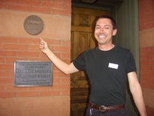
The picture of the Pinhorn Fire Proof Storage is circa 1920.
This building sat at 2255-2261 Blake.

The biggest change to the street scape came in 1909 when the Denio-Barr Milling and Grain Company opened its feed mill and elevator near the corner of 20th and Blake. This building dominated the area and sat adjacent to the 20th Street Viaduct until approximately 1992 when it was demolished in preparation for Coors Field. Luckily, yours truly shot some pictures of the area back in the day, and so I am now sharing these modern photos with you as well.

This photo, circa 1930, shows the viaduct, the grain elevator and the location of Duffy's, a moving and storage company.


Circa 1992, the grain elevator remains, but Duffy's is long gone. A former gas station sits at the right of the photo.


These two photos show the old Windsor Farm Dairy buildings which at one time held their wagon storage for deliveries. These buildings are not to be confused with the other Windsor buildings that still remain just down Blake near 19th. The top picture also shows the old grain elevator. The bottom view is near where the corner gates at 20th and Blake are at Coors Field today.


All demolished! Grain elevator, viaduct--GONE. Coors Field gets underway.


As mentioned above, the grain elevator's neighbor for many years was Duffy Moving and Storage as shown in the old picture above. Here are some photos, circa 1905, showing Duffy's horses and wagons.


By the late 1920s, change was brewing as a filling station was constructed at the corner of 20th and Blake. It stood on land owned by the Cowperthwaite family until 1992. Although abandoned, it was a reminder of a bygone era, when the romance of the automobile caught the attention of residents and thus began a long exodus of people from downtown. A portion of it can be seen in the modern picture further above in front of the grain elevator.


Other buildings which stood along Blake during the 1980s include the following:


2125 Blake


2145 Blake (This old building has been retained and can still be found on Blake Street next to Coors Field).


2101 Blake

All black and white historic photos are from the Denver Public Library's Western History Collection.

Wednesday, October 10, 2007

Cheyenne Place


Apologies to my regular readers for the delay in posting. I've had an unfortunate computer issue that has now hopefully been resolved. Before that meltdown, I had been working on the little known street called Cheyenne Place. Perhaps you haven't heard of it. It is the last street on the named downtown grid as one goes toward the intersection of Colfax and Broadway. In fact, Cheyenne Place intersects both streets at the extreme southeastern tip of the original congresssional grant that made up Denver City. There were more streets past Cheyenne Place, at least on paper, but they never came to fruition. They had names such as Smith, Dudley, Platte and Saint Charles

Today, the Denver Newspaper Agency dominates the area behind Cheyenne Place on blocks 244 and 267. There is no Block Number associated with the small triangular parcel that sits on the south side of Cheyenne Place. There is no business or street address for Cheyenne Place either. The only thing on Cheyenne Place is the familiar Pioneer Monument, installed in 1910. This statue was designed by Frederick MacMonnies. That's Kit Carson who rides a horse at its top. Originally, the plans called for an Indian to be placed atop. Those plans were scrapped due to the controversial subject matter. The Pioneer Monument is the symbolic end of the Smoky Hill Trail, which brought many early settlers to Denver (something equally controversial to the Indians!).


Prior to that time, there was another building on this site. In fact, it was Denver's first "real" fire station. Here are some pictures of that early time. This building was removed around 1909 as the immediate area began to transform into the Civic Center Park area we know today. The Pioneer Monument was one of the first items to be installed.


The last two pictures above show Broadway looking north with the fire station on the left.


This picture was taken just prior to demolition in 1909.


This picture from 1910 shows the newly installed Pioneer Monument on the left center side of the photo. The monument was originally on a circular platform. It has since been sitting on a triangular piece of land.


For well over a century, until the Denver Newspaper Agency put its building there, the land on the north side of Cheyenne Place has been dominated by transporation related uses.

This photograph from 1890 shows the Denver Omnibus and Cab Company north of the fire station. To the right is a partial sign for the Palace Stables.


This photo above from 1950 shows that the stables and stage shop have been replaced by AAA!


And the ultimate in car culture from 1970, the monument is now an afterthought, as it is just a mere neighbhor to the sea of parking behind it. The Arapahoe County Courthouse land is now the Hilton Hotel. This parking lot remained for nearly 25 years until the arrival of the Denver Newspaper Agency. The Pioneer Monument once again appears to "fit in" to its corner on Cheyenne Place, even if its one side facing Broadway is home to one of the city's seedier bus stops.

All historic photos are from the Denver Public Library's Western History Collection.